February Winter Storm Creates Dangerous Roads For Northeast
A strong winter storm moved through the Eastern half of the nation Tuesday and Wednesday with wintry precipitation expected for many areas. Heavy snow was expected from the Ohio Valley through the Northeast, some areas expected to see over 6 inches of snow. Meanwhile to the south, over a quarter of an inch of ice was anticipated for parts of the Lower Mississippi Valley stretching northeastward toward the Ohio Valley. Winter weather advisories stretched from northeastern Texas through Maine on Tuesday. (The image below was issued by the National Weather Service Tuesday afternoon, valid for Wednesday.)

Here’s a recap of what happened with this storm. Storm totals on Wednesday:
Freezing rain/ Ice:
- 0.30 inch White Oak, Ohio
- 0.25 inch Owenton, Ohio
- 0.25 inch Hillsboror, Ohio
- 0.33 inch Saint Clairsville, Ohio
- 0.25 inch Weriton, West Virginia
- 0.40 inch Cashtown, Pennsylvania
- 0.35 inch Shiloh, Pennsylvania
Snow:
- 11.0 inches Wells, New York
- 10.5 inches Amsterdam, New York
- 8.9 inches Landgrove, Vermont
- 8.0 inches Fishhouse, New York
- 8.0 inches Middlebury Center, Pennsylvania
- 7.0 inches Brookville, Pennsylvania
- 6.0 inches Salem, Ohio
- 5.0 inches Heath, Ohio
- 4.5 inches Centerville, Ohio
- 3.0 inches Oxford, Ohio
- 4.0 inches Springville, Indiana
- 3.8 inches Gulivoire Park, Indiana
- 3.1 inches Litchfield, Michigan
- 3.5 inches Henry, Illinois
- 3.9 inches Wyoming, Illinois
- 3.0 inches Weirton, West Virginia
- 4.7 inches Rochester, Pennsylvania
- 5.0 inches Becket, Massachusetts
- 6.0 inches Chatham, New York
- 7.5 inches North Troy, Vermont
- 8.0 inches Castleton, New York
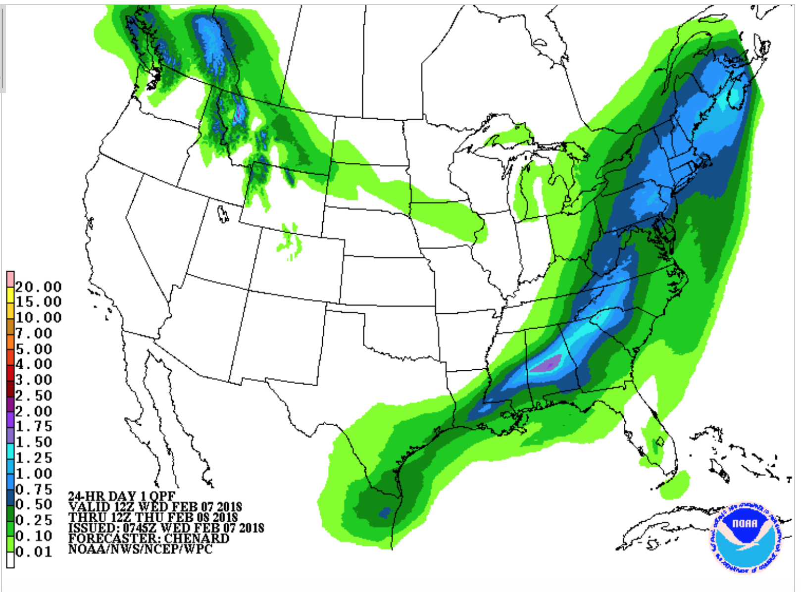
You can see from the Quantitative Precipitation Forecast from the National Weather Service the system had abundant moisture which allowed for these heavy snowfall totals across the Northeast with heavy rain and flooding as the system moved eastward from the Mid-Mississippi Valley on Tuesday, and into the Tennessee Valley and Gulf States on Wednesday. Road closures due to flooding have been reported in Ohio, Kentucky, and Tennessee.
Below are some pictures we got from our Facebook users. Please send us your crazy snow, ice, or flooding images by posting to our Facebook page. Or comment below to add your storm totals. How much snow or ice did you receive with this storm?
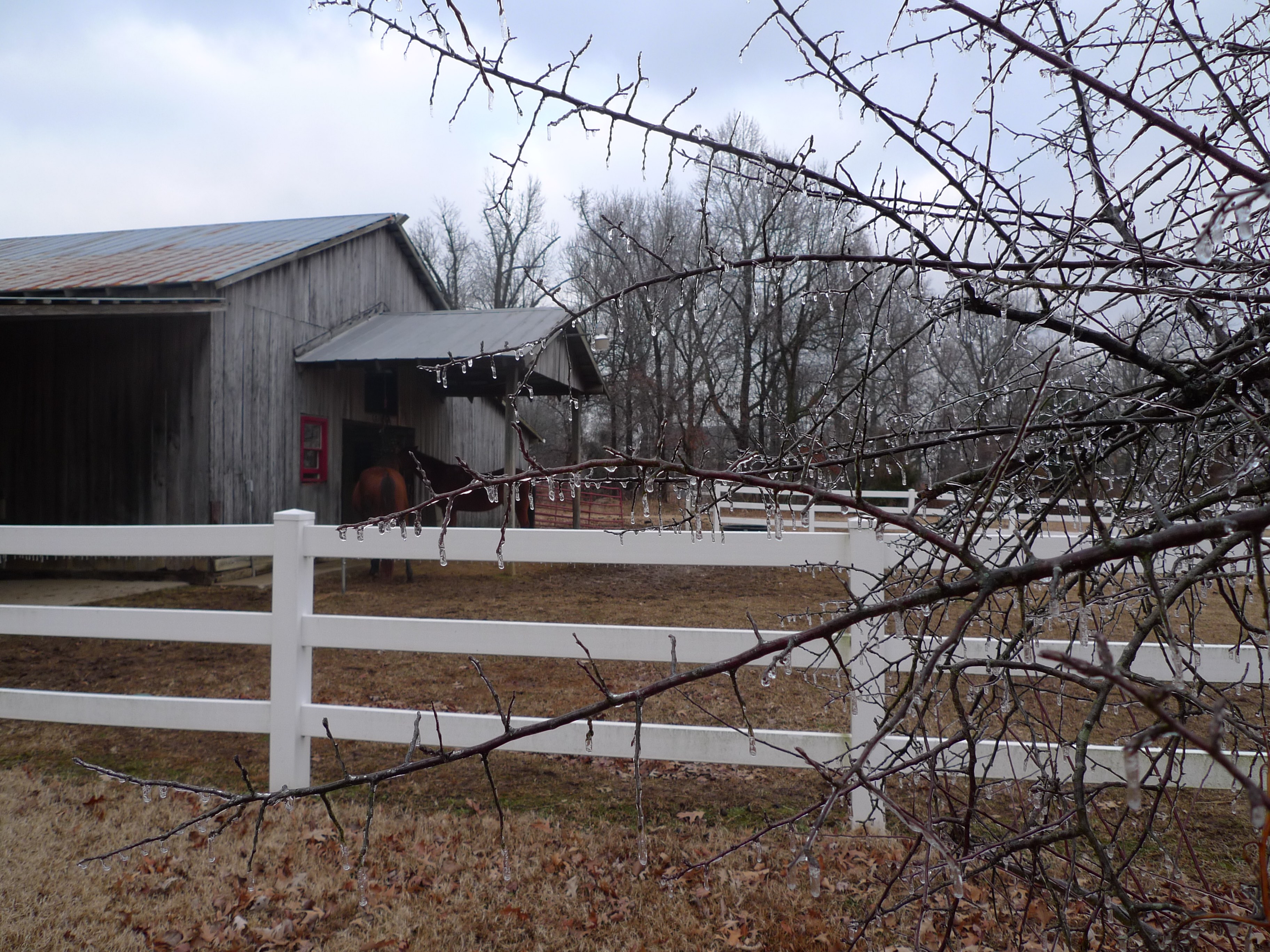 (Photo Credit: Chris K., Hanson, KY)


